Modern technology sometimes gives us Too Much Information and I experienced it yesterday. Barry was flying home from Naniamo, he had a short layover in Vancouver. His first flight was delayed a half hour and then the second flight was delayed 25 minutes so he was behind but it all was clicking so no worries… until they got to Prince George…
He was supposed to land in PG 1:07pm. With the delay he should have been there about 1:40. He always calls when he lands and at 2:00 I realized he hadn’t called yet so I googled his flight number and wow, look at what I got!!
This was the first screen I found, telling the flight was late (this screen shot was not the first one I got, originally it said the flight was delayed 50 minutes)
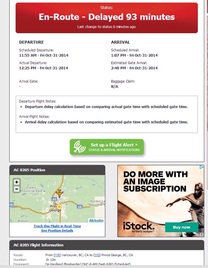
This was nice to see, good information. When I clicked on the map I got this info…
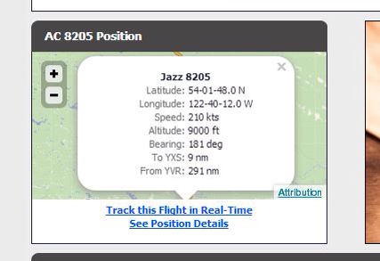
Again, this was good, then I clicked on “track this flight in real time”. This is what I got…
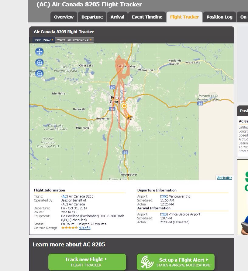
You can clearly see they had gone up to Salmon Valley and were circling. This concerned me a little but I didn’t think tOo much about it and went back to work. About 20 minutes later I refreshed the page and they had gone back to PG and then back up to Salmon Valley and were circling again, I started to get concerned so I clicked on “see position details”. This is when it really got scary! This table has their positioning every minute of the entire flight … Here is their take off out of Vancouver…
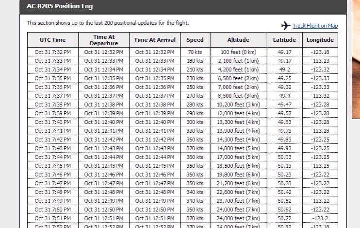
You can see them ascending and they get up to 24,000 ft and stay there until they arrive in the PG area, then it got crazy. I didn’t get a screen shot of their first approach but you could clearly see they had tried to land and got only 400 ft off the ground and had to pull back up, back to salmon Valley in a holding pattern again… Why??? I started to get nervous and couldn’t stop watching and refreshing these pages watching as they circled and circled and my imagination started to go wild… Is their landing gear? Is there a problem on the ground? What is going on? I went back to work again and after another 15 or 20 minutes I went back and I could see they had tried to land again… You can see it on this portion of the chart.
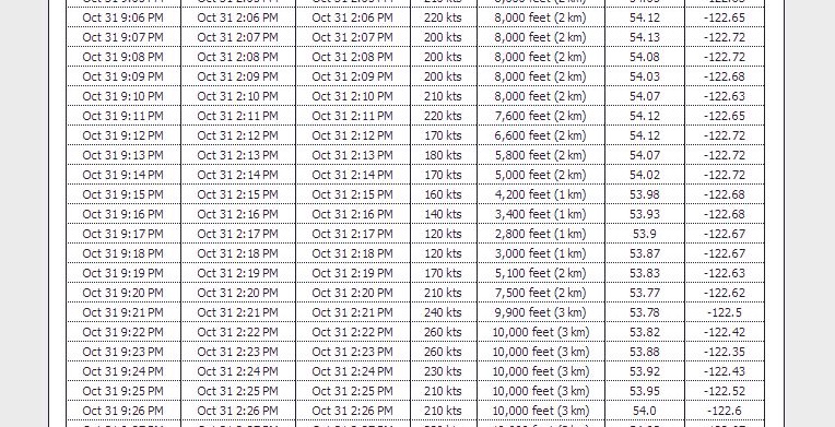
You can see they dipped down to 2800 ft and then went back up to a holding pattern. Well now I’m really freakin out and actually scared! Texting with Dallas and she is trying to keep my mind off it and telling me he’s fine… I went back to work again to keep my mind off it… Finally the phone rang and it was him, I almost cried. He had a nervous laugh that told me he had been more that a little concerned. His biggest fear was they were talking about landing in Ft St John… Their fuel had to be getting low, the flight was originally only an hour.
The best they could describe it was a combination of the river and pulp mill (when they flew into this very low fog it strongly smelled like pulp in the plane) and the weather conditions that this very thick fog was sitting over the airport and they were hoping for it to lift. The flight was an hour but they were in a holding pattern for 105 minutes.
So … Although this is a really cool tool to find and we will track other flights in the future… I need to be careful, knowing only half the story was not a good thing… Nowhere on the site did it say why they were not landing. I was freaked out!
He is home safe and sound …
